
Africa has won an unusual but powerful diplomatic victory at the United Nations, persuading the world body to support a map projection that shows the continent closer to its true size and challenging a centuries-old visual hierarchy that has shaped how generations have imagined the world.
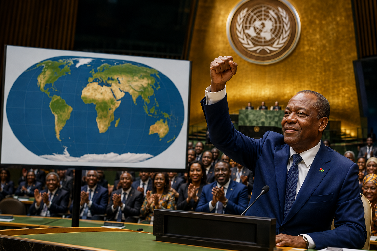
The United Nations General Assembly on Friday adopted a resolution championed by Togo calling for more accurate and equitable cartographic representation, with 164 countries voting in favour, one against and six abstaining. The United States was the only country to vote against the resolution. The measure promotes the Equal Earth projection as an alternative to the widely used Mercator projection, while stopping short of banning Mercator maps.
For Africa, the significance goes well beyond cartography.
The resolution does not redraw borders, change territories or alter the physical geography of the planet. It does not suddenly make Africa larger. Rather, it addresses something more subtle: the way a two-dimensional map can change the apparent importance and relative scale of entire regions.
That distinction is central to the African campaign.
For decades, the familiar Mercator world map has been used in classrooms, media organisations, institutions and digital platforms. It was designed in the 16th century primarily for navigation and has an important technical purpose. But when it is used to represent the relative size of continents, it produces striking distortions, particularly as land masses move farther from the equator.
The Equal Earth projection takes a different approach. It is an equal-area projection designed to preserve the relative size of land masses, making Africa, Latin America and other regions closer to their actual proportions.
The result is visually difficult to ignore.
Africa looks much larger.
And that is precisely why the issue has become important to a growing number of African campaigners, policymakers and institutions.
Why Africa cares about a map
Maps are often treated as neutral objects. They appear in textbooks, offices, news reports and websites as though they simply describe the world.
But cartographers have long known that every flat world map involves choices.
The Earth is roughly spherical. A map is flat. Something therefore has to give. Depending on the projection, a map can preserve direction, distance, shape or area, but it cannot perfectly preserve all of them simultaneously. Different projections are designed for different purposes.
The Mercator projection became particularly influential because of its usefulness to navigators. Straight lines on the map can represent constant compass bearings, making it valuable for maritime navigation. The trade-off is that areas become increasingly enlarged toward the poles.
That technical history matters because critics of Mercator’s widespread use argue that a tool created for navigation became, in many places, the default picture of the entire world.
The visual consequences can be dramatic.
Greenland can appear roughly comparable in size to Africa on a standard Mercator world map even though Africa is about 14 times larger in actual land area.
For someone who has grown up seeing the same map repeatedly, the distortion can become almost invisible.
That is the heart of the African argument.
The problem is not that Mercator is a “wrong” map in every circumstance. It is that using one projection for almost every educational and visual purpose can create a persistent impression of relative size that does not reflect geographic reality.
Togo’s Foreign Minister Robert Dussey framed the argument in deliberately political terms before the vote, saying: “A fair world begins with a fair map.”
That sentence captures the campaign’s broader ambition.
Africa is not asking the world to make the continent bigger.
It is asking the world to stop making it look smaller.
Togo puts Africa’s case to the UN
The initiative has been driven by Togo on behalf of the African Group, building on an earlier endorsement by the African Union.
The AU adopted the Correct the Map of Africa initiative in February 2026 and subsequently backed efforts to take the campaign to the United Nations. The continental body has described the initiative as part of a broader effort to ensure Africa is represented in ways consistent with its geographic scale and global contribution.
That African unity was important.
Rather than the issue being presented as a complaint by one country, Togo turned it into a continental diplomatic project.
The resolution ultimately attracted support far beyond Africa. France and Britain were among the countries supporting the measure, according to reporting on the vote.
The United States, however, opposed it.
Washington described the initiative as ideological and argued that the United Nations should focus on more pressing issues involving peace, prosperity and international relations.
The vote nevertheless demonstrated the extent of international support for the African position.
With 164 votes in favour, the United States stood alone in opposition while six countries abstained.
For African diplomats, that margin transformed what might once have been dismissed as a niche cartographic debate into a visible international statement.
The Mercator map was never designed to measure power
There is an important historical point that should not be lost in the political argument.
Gerardus Mercator developed his famous projection in the 16th century. Its great strength was navigation. It was not designed to suggest that European countries were inherently more important than African ones, nor was it created as a political ranking of continents.
That distinction matters.
Criticising the effects of Mercator is not the same as claiming that its original purpose was colonial propaganda.
The stronger argument is about what happened afterward.
As the projection became a familiar image of the world, it entered education and popular culture. The visual enlargement of northern regions became part of the mental picture many people carried with them, even when they knew intellectually that maps contained distortions.
Modern cartography offers many alternatives.
The Equal Earth projection, created in 2018 by cartographers Bojan Šavrič, Tom Patterson and Bernhard Jenny, was designed specifically as an attractive equal-area alternative for world maps. It preserves the relative size of land masses while maintaining a shape intended to remain visually familiar.
That makes it particularly useful for the argument now being advanced by African governments.
The choice is no longer simply between one old map and another.
It is between different priorities.
Should a world map primarily help a sailor maintain a compass bearing?
Should it make continents visually pleasing?
Should it preserve shapes?
Or should it give viewers a reliable sense of the relative amount of land occupied by different parts of the world?
The answer depends on the purpose.
And this is why the UN resolution does not require the disappearance of Mercator.
The resolution does not ban Mercator
One of the easiest ways to misunderstand Friday’s vote is to describe it as the United Nations “banning” the Mercator map.
It does not.
The resolution is not legally binding. It encourages greater use of projections that represent land areas more accurately, particularly in contexts such as education, institutional communications and public information.
Togo has also made clear that the initiative does not challenge Mercator’s continued use for maritime and aerial navigation, where the projection remains suited to particular technical purposes.
That leaves considerable room for different projections to coexist.
A navigation chart may continue to use Mercator.
A geography textbook could use Equal Earth.
A news organisation might use one projection for a global population graphic and another for a map showing shipping routes.
The question is therefore not whether Mercator disappears.
The question is whether institutions continue using it automatically when another projection would communicate geographic reality more effectively.
Schools could become the first battlefield
The most immediate impact could come in education.
Children do not normally learn cartographic theory when they first encounter a world map. They see a picture and absorb it.
Over time, that picture becomes familiar.
Togo has said it intends to change its school geography materials by the end of this year and to encourage other governments, schools and institutions to reconsider the maps they use.
That could make education one of the most important arenas for the campaign.
A child who sees Africa represented according to its actual relative area is not necessarily going to develop a radically different worldview overnight.
But the cumulative effect matters.
If Africa is shown at its true scale in textbooks, classroom walls, examinations and educational websites, the continent’s physical presence becomes harder to mentally minimise.
This is especially relevant because Africa is frequently described through statistics about population, economic development, poverty, conflict or natural resources.
The map adds another layer.
It provides a basic visual reference for understanding the continent’s physical scale.
Africa covers about 30.3 million square kilometres, making it the world’s second-largest continent by land area. Its size allows the United States, China, India and much of Europe to fit within it in various comparisons, although such comparisons depend on how territories and geographic boundaries are defined.
Yet conventional world maps can make that scale surprisingly difficult to appreciate.
An equal-area map offers a corrective.
From cartography to cognitive justice
The African campaign is also connected to a much larger conversation about historical representation.
Supporters argue that maps are part of the infrastructure through which societies understand power.
That argument is not limited to Africa.
Countries and communities around the world have challenged maps that they believe place their territory, history or identity in an inappropriate visual context.
For Africa, however, the debate carries particular weight because cartography was deeply connected to European exploration, imperial expansion and colonial administration.
Colonial powers did not simply occupy territory. They mapped it, named it, measured it and incorporated it into systems of administration and global commerce.
Modern African states inherited many of those geographic frameworks.
The Correct the Map campaign does not claim that changing a projection will undo colonialism.
Nor can a new map solve Africa’s much larger political and economic challenges.
But supporters argue that representation matters because repeated visual distortions can influence perception.
The campaign has therefore used language around fairness, accurate representation and cognitive justice. The AU has described the initiative as part of a wider effort to reposition the continent in global narratives.
For a platform such as Who Owns Africa, this is where the story becomes especially significant.
The central question is not simply what Africa looks like on a map.
It is who gets to decide how Africa is seen.
Africa does not need to be made bigger
There is an important irony at the centre of the debate.
Africa does not need a flattering map.
It needs an accurate one.
That distinction protects the campaign from the charge that it is simply seeking symbolic enlargement.
Equal Earth is not an African nationalist projection designed to exaggerate the continent. It is an equal-area projection that applies the same mathematical principle across the globe.
Europe does not become “smaller” because someone wants to diminish Europe.
North America does not become “smaller” because someone wants to punish the United States.
Greenland does not become smaller because of an African political campaign.
They appear differently because their actual areas are being represented under a different mathematical system.
That is the more powerful argument.
Accuracy does not require propaganda.
It requires choosing a projection suited to the question being asked.
Africa’s campaign is effectively asking schools, governments, media organisations and technology companies to consider whether the maps they use actually serve that purpose.
The technology companies are next
The most difficult part of the campaign may not be winning a UN vote.
It may be getting the map changed on screens.
Modern geography is increasingly digital. People encounter the world through search engines, mapping applications, navigation services, data visualisations, social media graphics and news websites.
A UN resolution cannot simply order those platforms to redesign their maps.
The companies that control much of the world’s digital cartography operate according to technical, commercial and user-experience considerations.
Togo has indicated that discussions will therefore need to include technology companies and businesses involved in mapping and location services.
That could become the next phase of the campaign.
If schools adopt Equal Earth but major digital platforms continue presenting the Mercator projection in general-purpose world maps, the effect will remain fragmented.
The same is true for international organisations and media outlets.
A map printed in a textbook may show Africa at its correct relative scale while a television graphic, website illustration or corporate presentation immediately returns to the familiar Mercator image.
Changing visual habits requires consistency.
France adds momentum
The debate has already begun influencing countries beyond Africa.
France announced ahead of the UN vote that it would move away from Mercator for world map representations in favour of projections better suited to particular purposes and more faithful to actual surface areas. French Foreign Minister Jean-Noel Barrot said distortions could eventually influence perceptions and argued that the time had come to correct them.
That is significant because it demonstrates that the African campaign is not necessarily about Africa versus Europe.
European governments can accept the mathematical case for a different projection without accepting every political argument surrounding colonial history.
That may ultimately be the most sustainable path for the initiative.
The campaign is strongest when it separates two questions.
First, is the map geographically accurate for the purpose for which it is being used?
Second, what historical and political consequences have resulted from its widespread use?
The first question can be answered scientifically.
The second requires a much broader debate.
A diplomatic win, but not yet a cultural revolution
For all the symbolism surrounding Friday’s vote, the practical consequences will depend on what happens next.
UN General Assembly resolutions of this type can carry considerable political weight without creating binding obligations for governments.
The vote therefore establishes a principle, rather than completing a global transition.
Togo has said it wants to press governments, schools, international organisations and technology companies to adopt more accurate representations.
The African Union’s endorsement provides continental backing.
But implementation will require cartographers, publishers, teachers, designers, software developers and policymakers to make different choices.
That process could take years.
There is also no single “perfect” world map.
Every projection introduces some form of distortion. The US Geological Survey notes that a flat map cannot simultaneously preserve all of the Earth’s true directions, distances, areas and shapes.
Equal Earth solves one major problem by preserving relative area, but it does not eliminate every form of distortion.
That is not a weakness.
It is a reminder that the debate should be about using the right map for the right purpose.
What the vote means for Africa
The immediate result of Friday’s vote is therefore modest in technical terms but large in symbolic terms.
No African border has moved.
No territory has changed hands.
No navigation system has been forced to abandon Mercator.
But the General Assembly has endorsed an African-led argument that something as ordinary as a world map can influence how regions are perceived.
And it has done so by an overwhelming margin.
The 164-1-6 vote gives Togo and the African Union a diplomatic platform from which to push the campaign into schools, media organisations and digital mapping systems.
It also gives African policymakers another example of continental diplomacy producing a result at a major multilateral institution.
For decades, debates about Africa’s place in the world have often centred on trade, debt, security, climate finance, natural resources and representation in global institutions.
Now there is another question on the table.
Who controls the picture?
That question may sound less consequential than questions about money or military power.
But images shape assumptions.
A map is one of the first images through which many people learn what the world looks like.
If that picture repeatedly enlarges some regions while shrinking others, it can become part of the background architecture of perception.
Correcting it will not transform Africa’s economies or end its political problems.
But it can remove one small, persistent source of distortion.
The real test begins after the vote
The UN resolution gives Africa something valuable: attention.
The challenge now is to convert that attention into practical change.
Togo wants its schools to begin the transition this year. African campaigners want more accurate maps in classrooms, textbooks, newsrooms, businesses and digital platforms.
That is a much harder task than securing votes at the United Nations.
It will require convincing institutions that changing a map is worthwhile, persuading technology companies to adjust established systems and educating the public about why different projections exist in the first place.
It will also require discipline from African advocates.
The strongest case is not that the old map was deliberately designed to make Africa look insignificant.
The strongest case is that a projection created for a particular technical purpose became a dominant visual representation of the world, despite distorting the relative size of continents.
That distinction matters.
Africa’s victory is more credible when it is rooted in scientific accuracy rather than political grievance.
The Equal Earth projection provides that foundation.
It was created by cartographers, is mathematically equal-area and offers a practical alternative for global maps.
The political meaning comes from what Africa has chosen to do with it.
For Who Owns Africa, that is the story worth following.
The map is only the beginning.
The deeper question is whether Africans can gain greater influence over the narratives, systems and institutions through which the continent is represented to the rest of the world.
The United Nations has now given that question a global stage.
Africa did not ask the world to redraw the continent.
It asked the world to look at it properly.
And on Friday, the world voted overwhelmingly to do so.

More from Politics
Libya: Who really owns the state?
Libya’s oil wealth is expanding, but political fragmentation exposes the deeper struggle over institutions, military power and national sovereignty.
Abiy Ahmed begins new term as Ethiopia faces security and regional challenges
Ethiopia’s new political chapter begins with a stronger mandate, but unresolved conflicts and regional rivalries could define Abiy Ahmed’s second term.

Wicknell Chivayo: What his rise reveals about Zimbabwe’s business and political elite
The rise of Wicknell Chivayo reveals how wealth, state contracts, philanthropy and political access are reshaping Zimbabwe’s modern power structure.